|
TROPICAL WEATHER UPDATES Satellites / Spaghetti Model Pages: CSU / Albany / Google AI / PolarWX Cyclonicwx / DuPage / Fox / McNoldy / FSU Weather / Tropical Tidbits / Weathernerds GFS EURO CMC ICON HRRR |
 Weather Page is LIVE as of / Read About Mike on Wikipedia / Tropical Meteorology Winner / Contact MWP Storm Names / NHC Discussion / #1 #2 #3 #4 #5 #6 #7 #8 #9 #10 / Hurricane Harbor / MWP Songs / Buy MWP Merch Note: Please read my privacy policy below and disclaimer. Please consult with the NWS/NHC for official forecasts and planning. |
 Firman US Power Outage Tracker Map Get 30% off a Firman & FREE Shipping - Here |
Current UTC Time: UTC Time Conversion Models run on Z time |
||||||||
|
MWP IS ON SOCIAL MEDIA:  NOAA Tropics Audio Outlook: Get Mikes APP on Apple & Android Devices:  CURRENT WEATHER IMAGES/LINKS: Great Links from UW-Madison CIMSS 500mb Vorticity / 200mb Vorticity Sea Surface Temps: Live Water Temps  / What They Effect 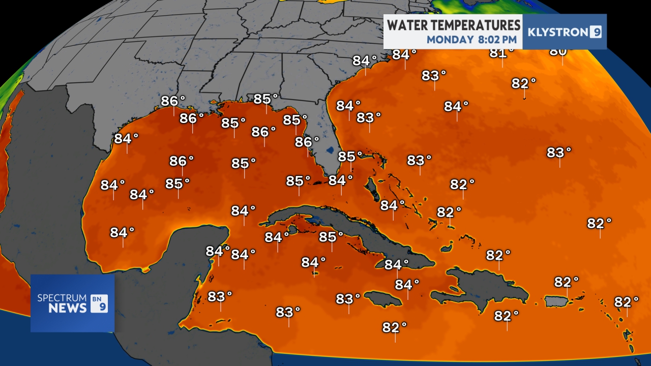 Tropics generally need 80F 27C Tropical Cyclone Heat Potential:  Sea Surface Temp Anomaly: 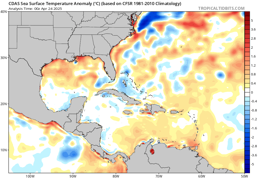 Sea Surface 7-Day Temp Change: 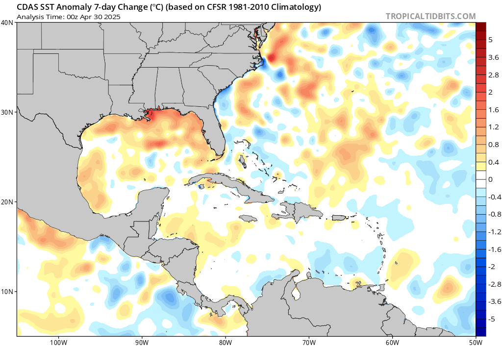 Wind Shear Map:  Vertical Wind Shear:   Current Lower Winds Current Upper Winds Airport Delays: Live Flight Tracker Map Jet Stream Pattern:  Jet Stream Forecast / Jet Stream Animation ASCAT/WindSAT Winds: 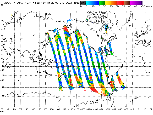 Current and Future WindAlert Winds:  Current Winds of the Earth: 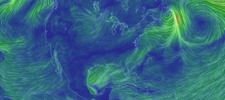 See Your WINDS MJO Forecast: 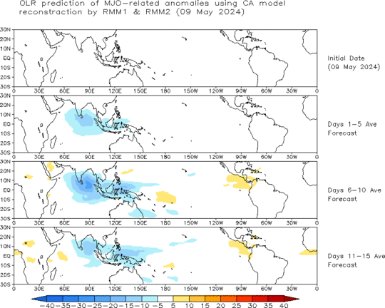 Velocity Potential: 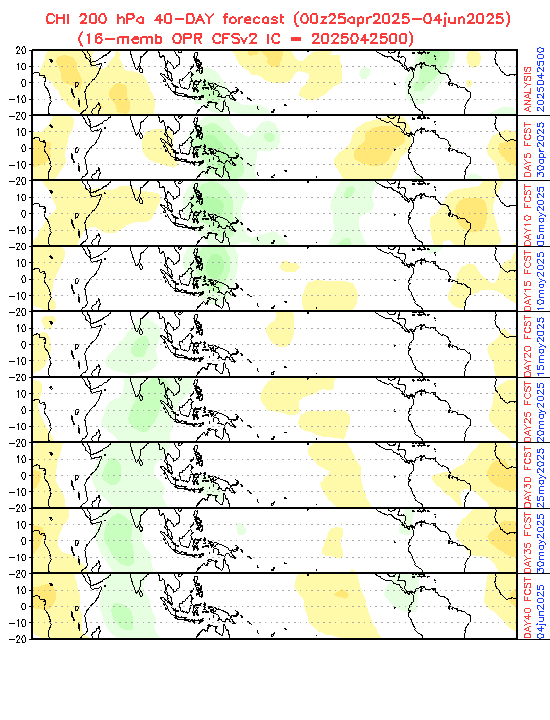 Saharan Air Layer: 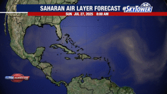 Current Lightning Strikes:  River Forecasts & Observations: 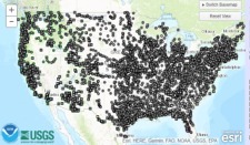 Buoy Data: 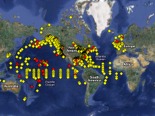 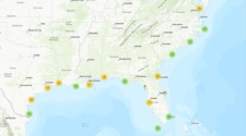 CERA Coastal Storm Surge Map: 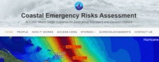 Surge Map / Surge Potential / Storm Surge? Forecast Wave Heights: 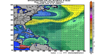 NOAA Graphical Analysis Current Wave Heights: 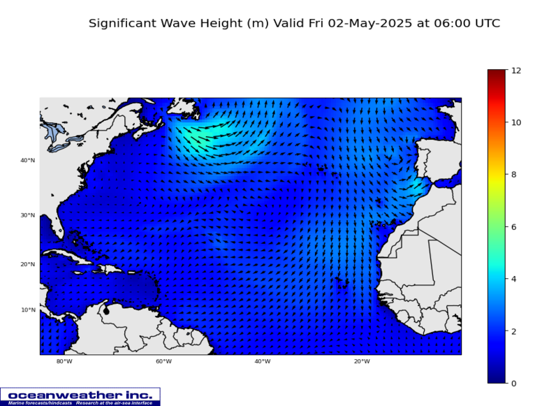 Surf Forecast / Red Tide / Red Tide Zoom 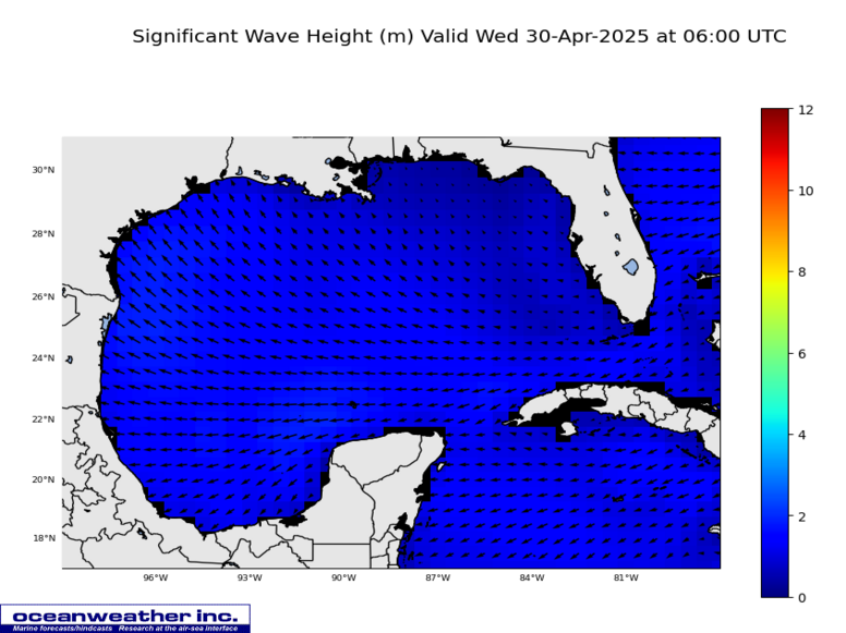 Wave Maps / Gulf Waves / Caribbean Waves Ocean Currents: 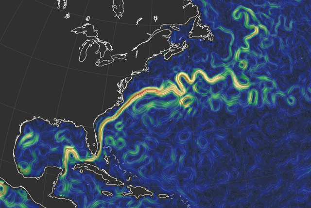 Live Marine Traffic Map / Wave Watch Model NOAA Marine Forecasts by Regions: 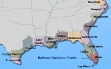 U.S. Coastal Tide Charts / Tideschart.com Saffir-Simpson Hurricane Scale: 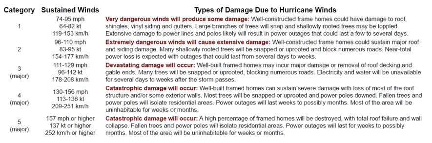 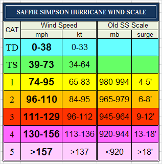 Beaufort Wind Scale dBZ Scale from Radar: 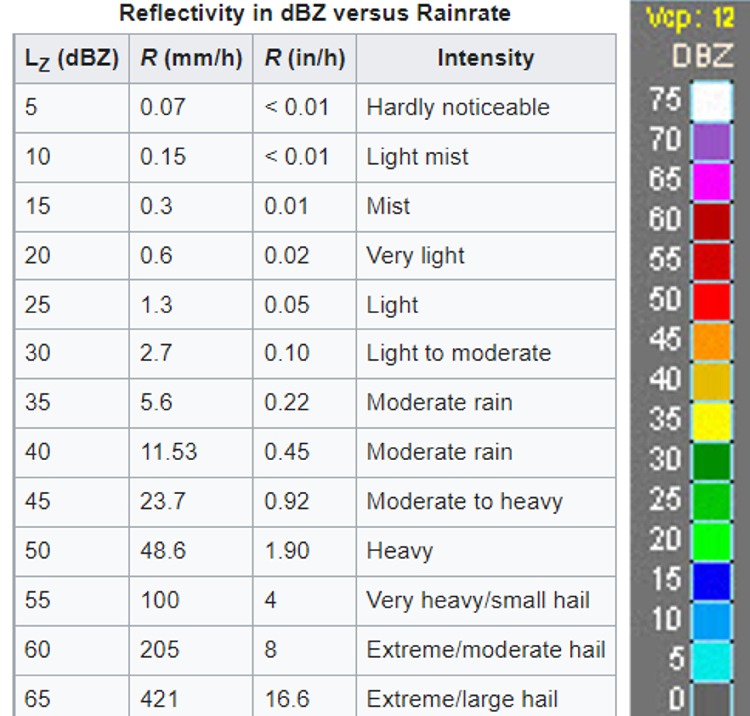 LIVE Earthquake Page: 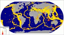 24-Hour Quake Maptsunami.gov US Drought Monitor: 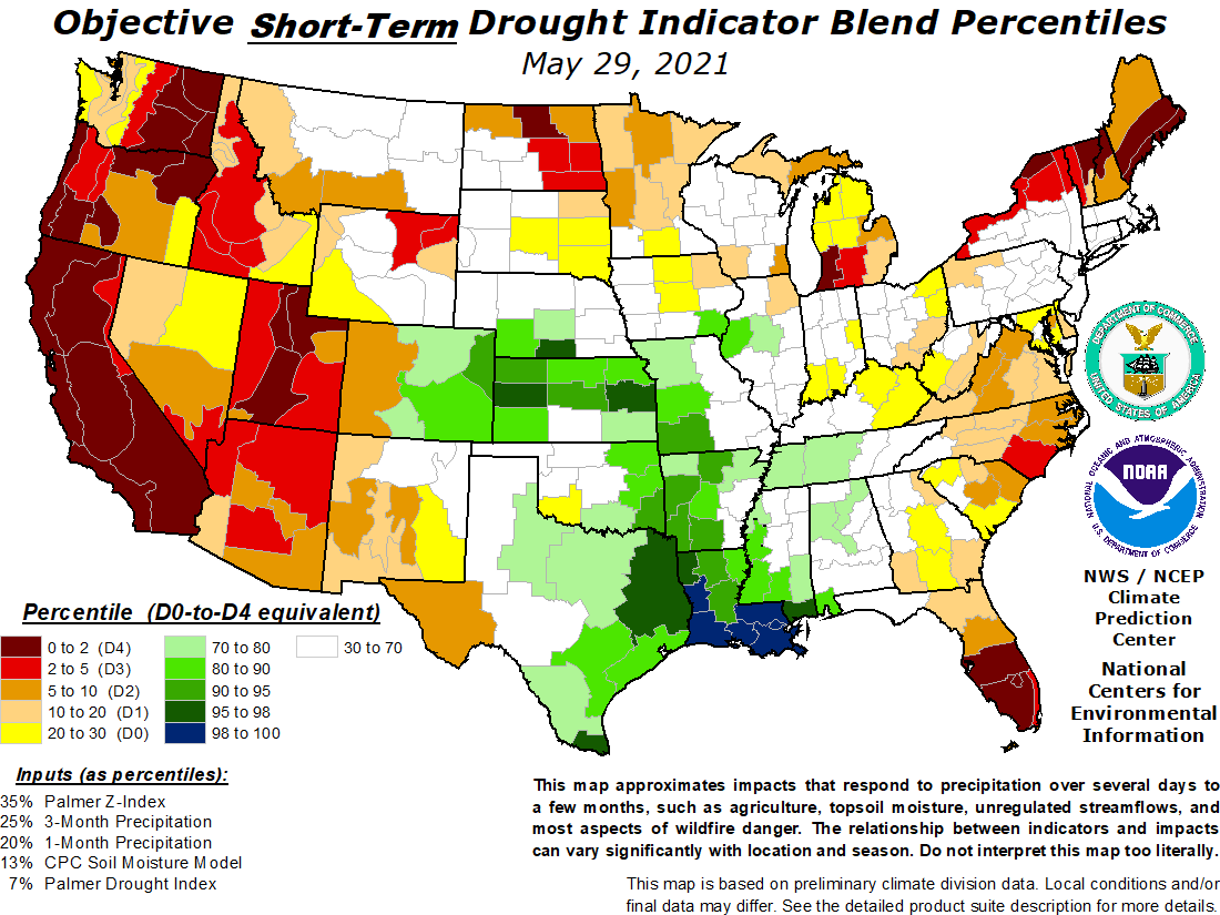 US Wildfire Potential:  Fire MapSmoke MapFire Outlook UV Index Forecast: 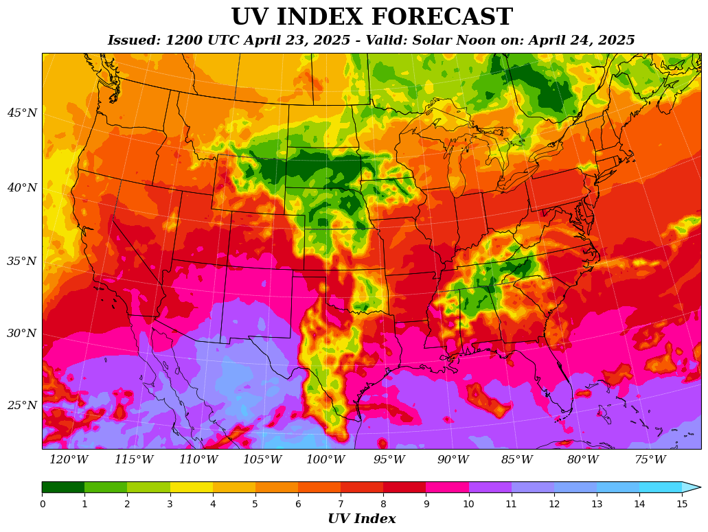 Air Quality MapAir Pollution Map  |
|
|
24-Hour Rain Forecast: Next 5-Days Rain Forecast:   QPF Page / Day After Tomorrow Rain / 7-Day Forecast Excessive Rain OutlooksToday and Tomorrow:     Excessive Rainfall WPC Page Your Local NWS Alerts Map: Click map then your area. Critical Weather Status  NWS Colors Key / Current Warnings / Interactive Current Tornado and Severe Thunderstorm Watches:  SPC Storm Outlooks: SPC Colors Key / Nadocast
STORM OUTLOOK
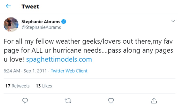
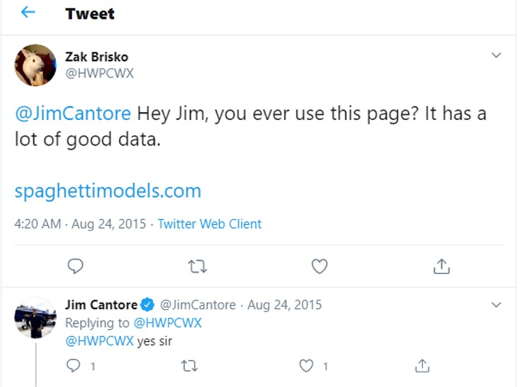
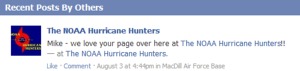
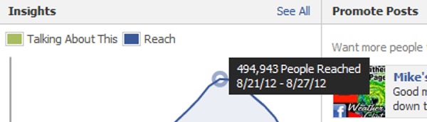
Storm Prediction Center / Storm Chasers / WPC Tomorrow's Outlook: Day After Tomorrow:   CIPS Severe / CSU / SPC Detailed / Lifted Index Day 4-8 Storm Outlook: SPC Color Descriptions:   Yesterdays Storm Reports: / Tornado Stats / Florida Tornadoes  Day 3-7 Hazards Map:  Click Play for the EURO 10-Day Forecast: Windy.com / Ventusky.com Current Power Outages: Current Skycover: Wind Speed & Direction: 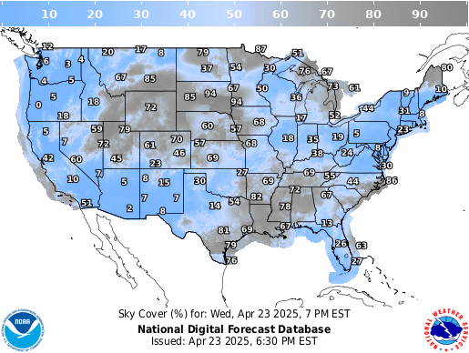 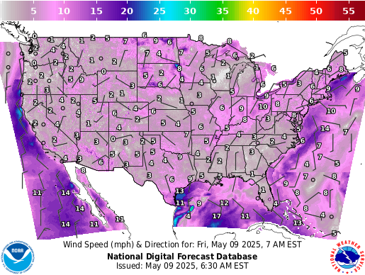 The Next Few Days Forecast:  WPC Interactive Page Day 1-3 / Animate Day 1-7 Today's Weather Forecast: 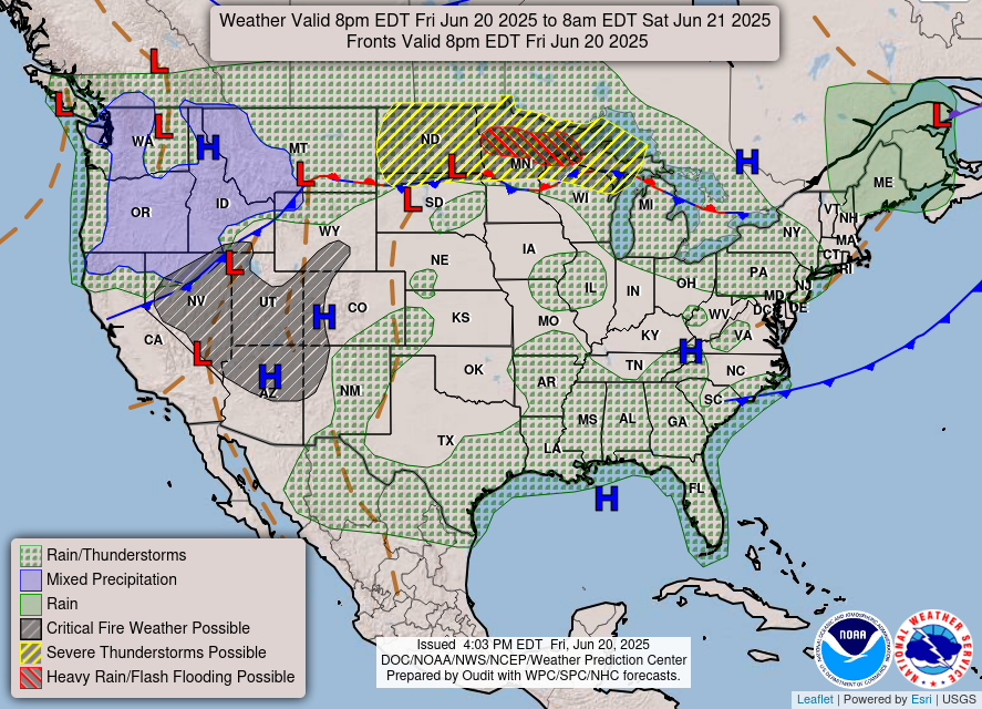 Tomorrow's Forecast: Day After Tomorrow's Forecast: 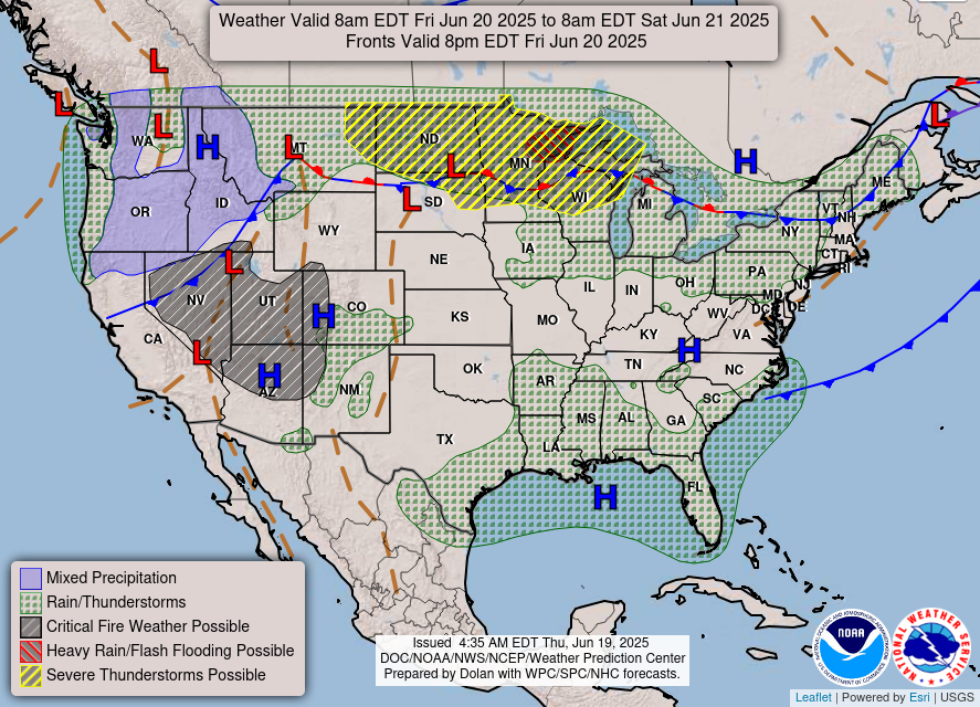 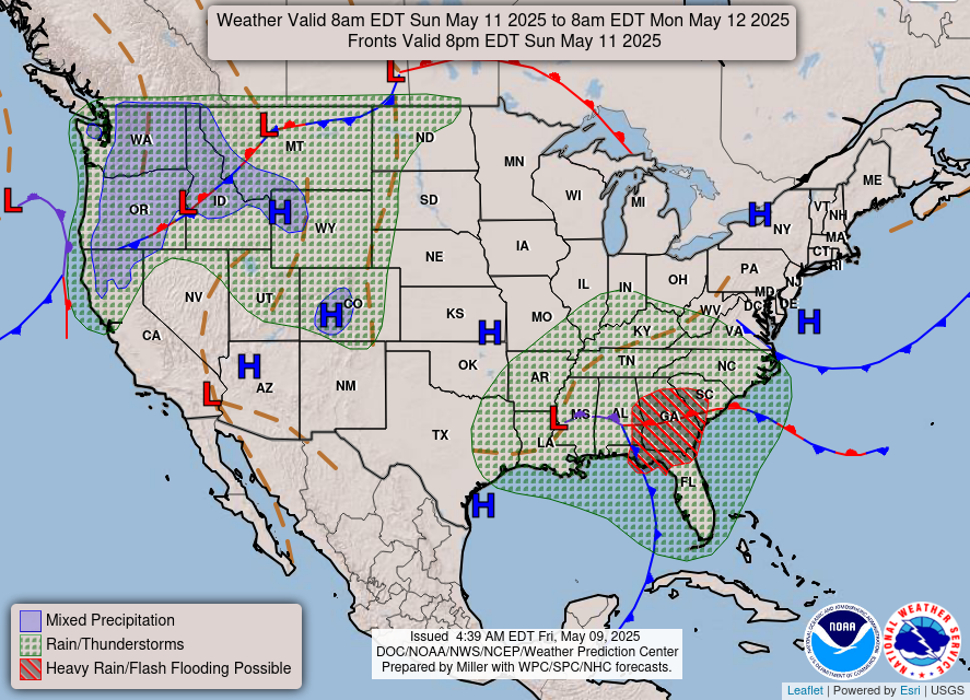 Hawaii Weather / Alaska Weather Day 3-7 Weather Forecast:  7 Day Loop of Surface Analysis / Surface Analysis Charts Daily PrecipitationWeekly Precipitation: NOAA Rain Totals / Yesterday's Radar / CoCoRaHA Totals Current Temperatures: Detailed Temps / Daily Temp Records / Potential Records High Temperature Forecast: Low Temperature Forecast:   Weather History / Wx Stations / Data Archive / Wx History DPollen Count:   Current Heat Index Leaders / NWS Heat Risk CURRENT SUN AND MOON MAP: Solar Cycle Progression Northen Lights / Ozone Watch / Sunset Map / Moon WEATHER LINKS: Weather Channel's Stephanie Abrams likes Mike's: Here Weather Channel's Jim Cantore follows Mike's: Here The famous NOAA Hurricane Hunters like Mike's: Here NOLA Homeland Security & Emergency like Mike's: Here 1/2 Million reached on Facebook during 2012 Isaac: Here 8 Million reached on Facebook during 2021 Laura: Here ABC Action News Hurricane Special from Mike's: Here
|
Thanks to all the supporters of Mike and Mike's Weather Page. Your help enables all that we do, from the webstite and app, to storm chasing, seminars, education, social media, and more. Has Mike Helped You / Mike's Reviews / 99% Trust Mike 
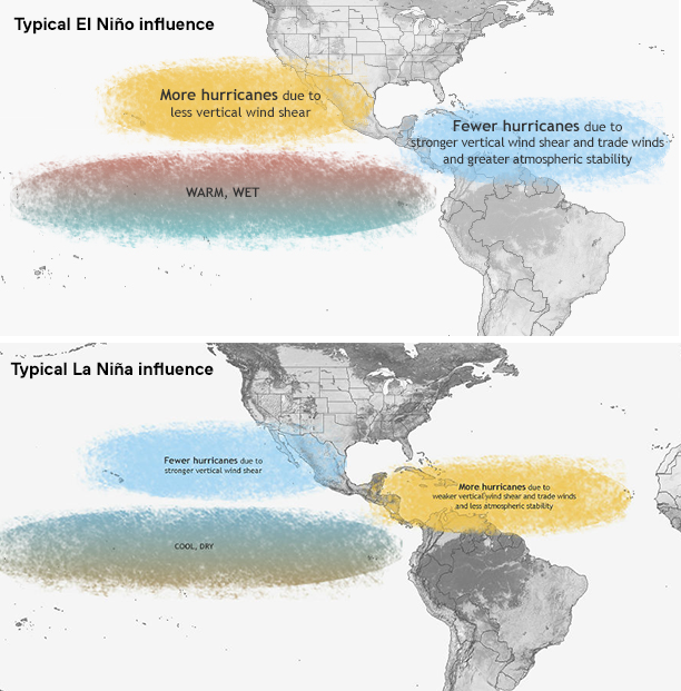
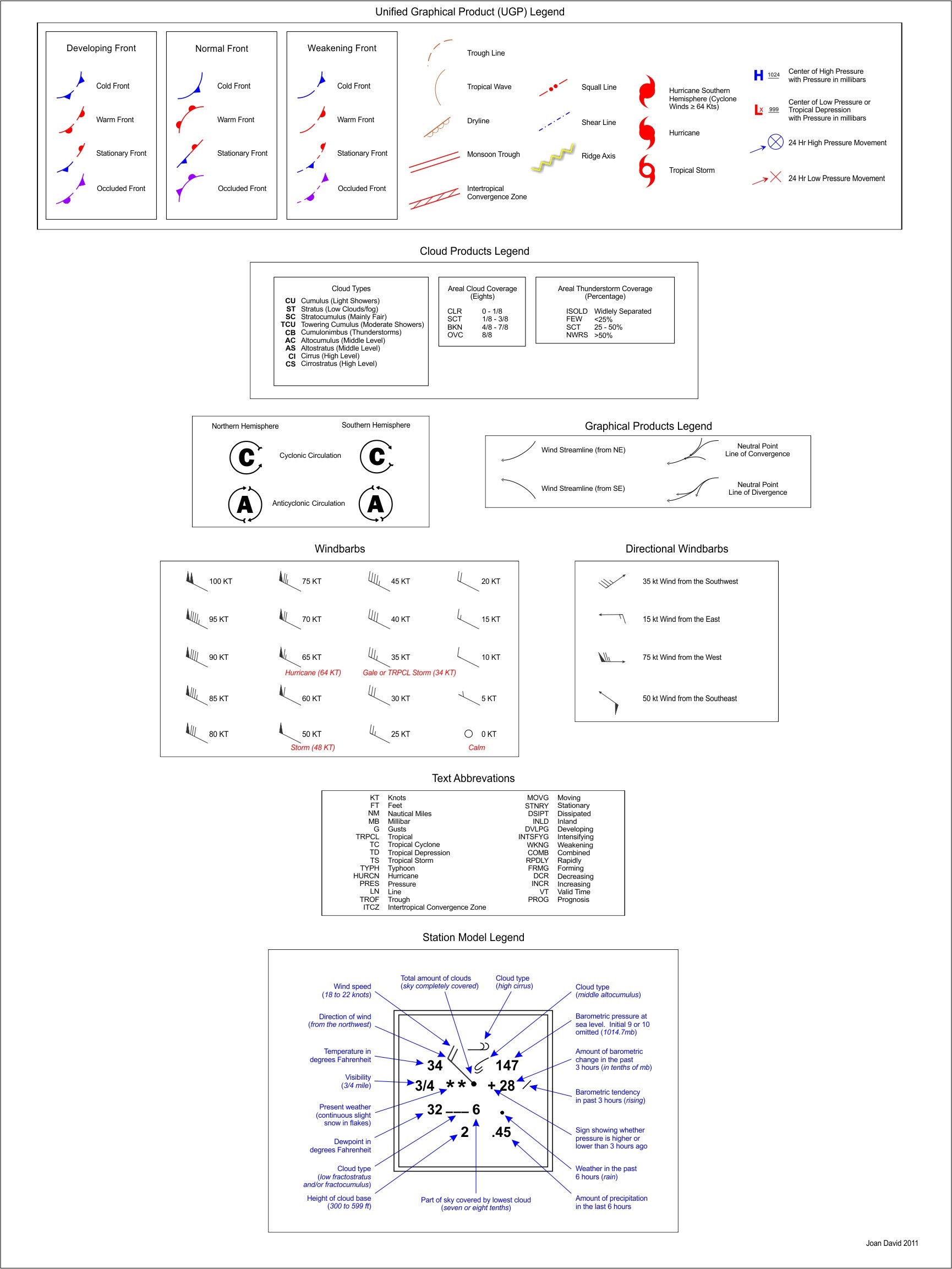
Florida / East Coast / Upper Gulf / Northeast  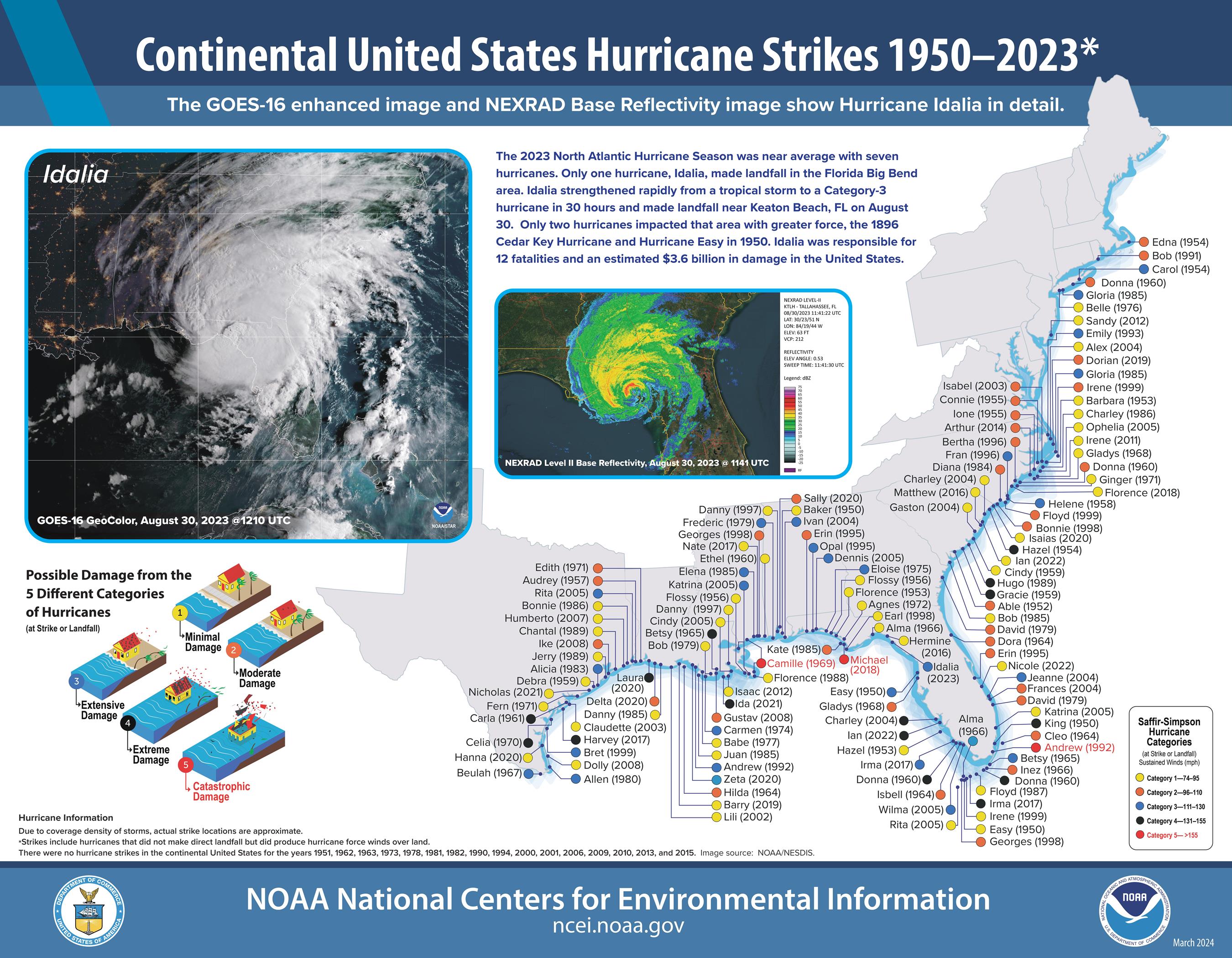 LINKS ON VARIOUS STORM INFO AND STUFF: Tracking Charts / Past Tracks / History / Model Accuracy Storm Cyclopedia / Bermuda High / Tropical Terms / AMO Model Types / MB's / Legend / How Storms Form / Fronts El Nino / El Nino Explained / Watches/Warnings / Wildfires Drought Monitor / Monsoon SW Weather / Compare Canes °F to °C / USA Power Outages / Tornado Formation / TUTT Storm Radar History / 50 Star Search and Rescue / Radar? Cape Launch Info / Todays Weather History Wind Barbs / NAO / Webcams / FEMA Risk Index Hebert Box / Storm Surge Explained / Scalable Map INFORMATION ON TROPICAL CYCLONES: NHC Hurricane Planning: NWS Hurricane Plan & Prepare Custom NWS Text Products A hurricane is a tropical cyclone, which generally forms in the tropics and is accompanied by thunderstorms and a counterclockwise circulation of winds. Tropical cyclones are classified as follows: Tropical Depression: Organized system of clouds/ thunderstorms with defined surface circulation & max sustained winds of 38 mph or less. Tropical Storm: Organized system of strong thunderstorms with a defined surface circulation & maximum sustained winds of 39-73 mph. Hurricane: Intense tropical weather system of strong thunderstorms with a well-defined surface circulation & max sustained winds of 74 mph or higher. The Atlantic Hurricane Season is from June 1 - November 30 HURRICANE WATCHES AND WARNINGS: - When a Hurricane Watch is issued for your part of the coast this indicates the possibility that you could experience hurricane conditions within 48 hours. This watch should trigger your family's disaster plan, and proactive measures should be initiated especially those actions that require extra time such as securing a boat, leaving a barrier island, etc. - When a Hurricane Warning is issued for your part of the coast this indicates that sustained winds of at least 74 mph are expected within 36 hours. Once this warning has been issued, your family should be in the process of completing proactive actions and deciding the safest location to be during the storm. See the Difference Betweeen a WATCH and a WARNING WHAT ARE SOME HURRICANE HAZARDS: Storm Surge: Water that is pushed toward the shore by the force of the winds swirling around the storm. This advancing surge combines with the normal tides to create the hurricane storm tide, which can increase the mean water level 15 feet or more. Inland Flooding: In the last 30 years, inland flooding has been responsible for more than half the deaths associated with tropical cyclones in the US. High Winds: Hurricane force winds can destroy poorly constructed buildings and mobile homes. Debris such as signs, roofing material, and small items left outside become flying missiles in hurricanes. Tornadoes: Hurricanes can produce tornadoes that add to the storm's destructive power. They are most likely to occur in the right-front quadrant of the hurricane. / Homeowners checklist / Fact sheet Supply Preparedness / All about window shutters Evacuate or Stay / Family and Individual preparedness Should you crack your windows / Protecting from wind Family disaster Plan and Evacutation / Disaster eating guide Interactive wind maps / Hurricane Tidbits / Lightning safety Water Damage Advisor / FloodSmart Community Resources Red Cross Checklist / Protect home from flood damage Emergency Planning / Protect Pets / Flood damaged cars STEM challenge for kids / Building flood resistant homes Pet Disaster Prepardness & Recoveryng / Pet Safety Hide from the Wind / Basement Flooding / How to Prepare Hurricane Homeowner Guide / Kids & Natural Disasters Helping those with Disabilities WHAT ACTIONS TO DO TO BE PREPARED: Have a Family Disaster Plan and Disaster Supply Kit. Build or identify a Safe-Room in your Home. Purchase a NOAA Weather Radio with a tone alert feature, which allows you to receive warnings by your local NWS office. Inquire if your Community is StormReady. MONTHLY AREAS OF ORIGIN AND TRACKS: Cyclone Climatology / Past Radar / Storm History / Florida History 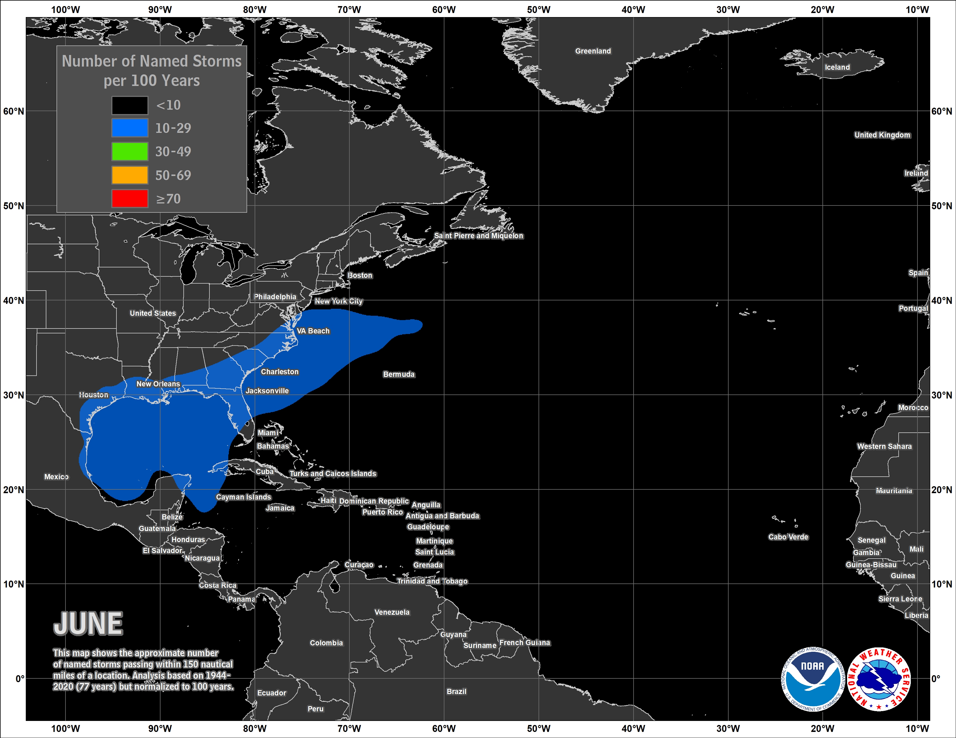 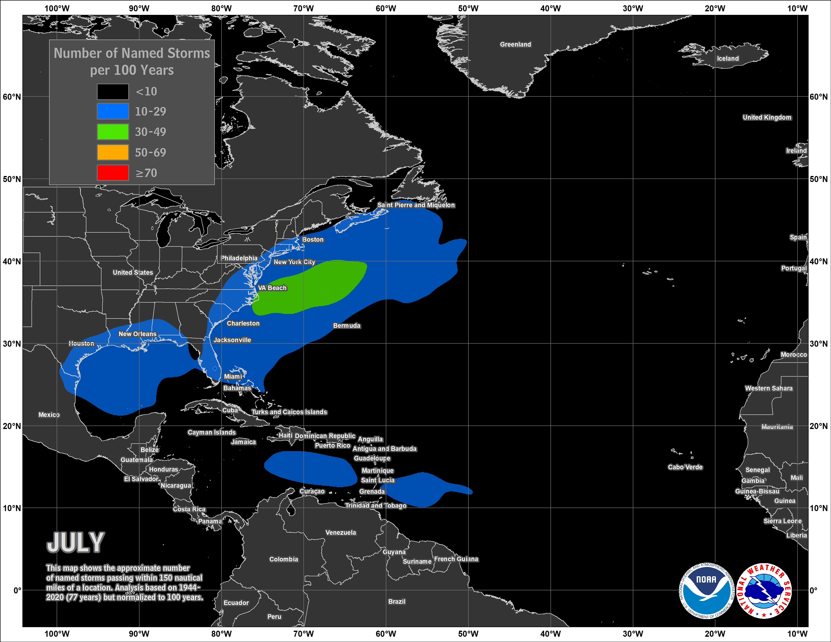 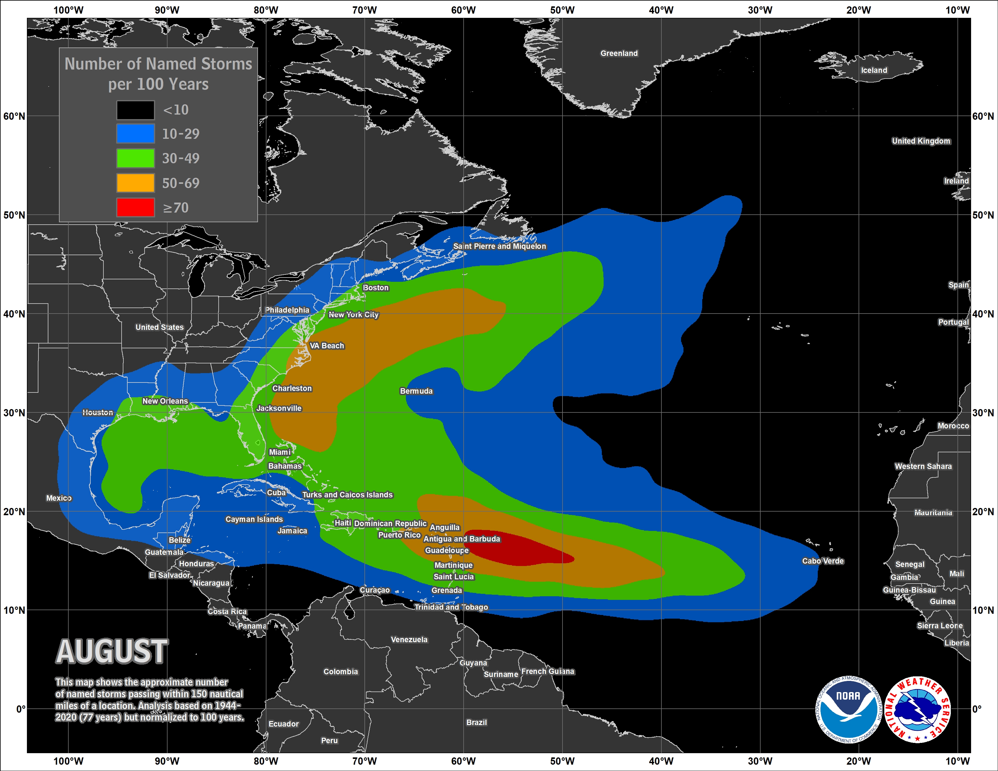 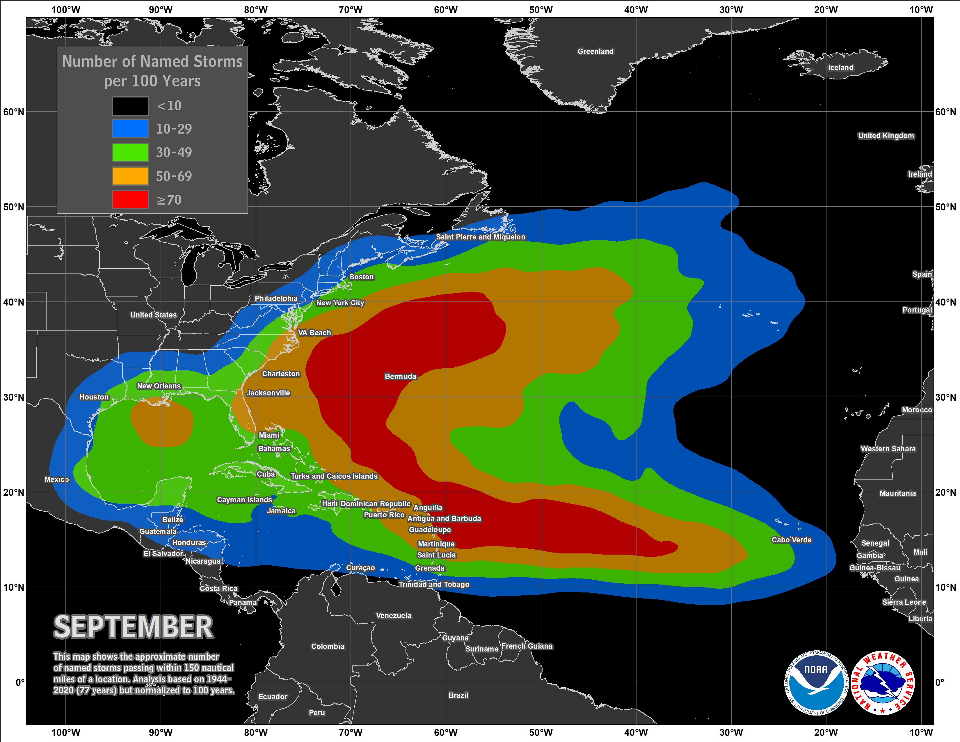 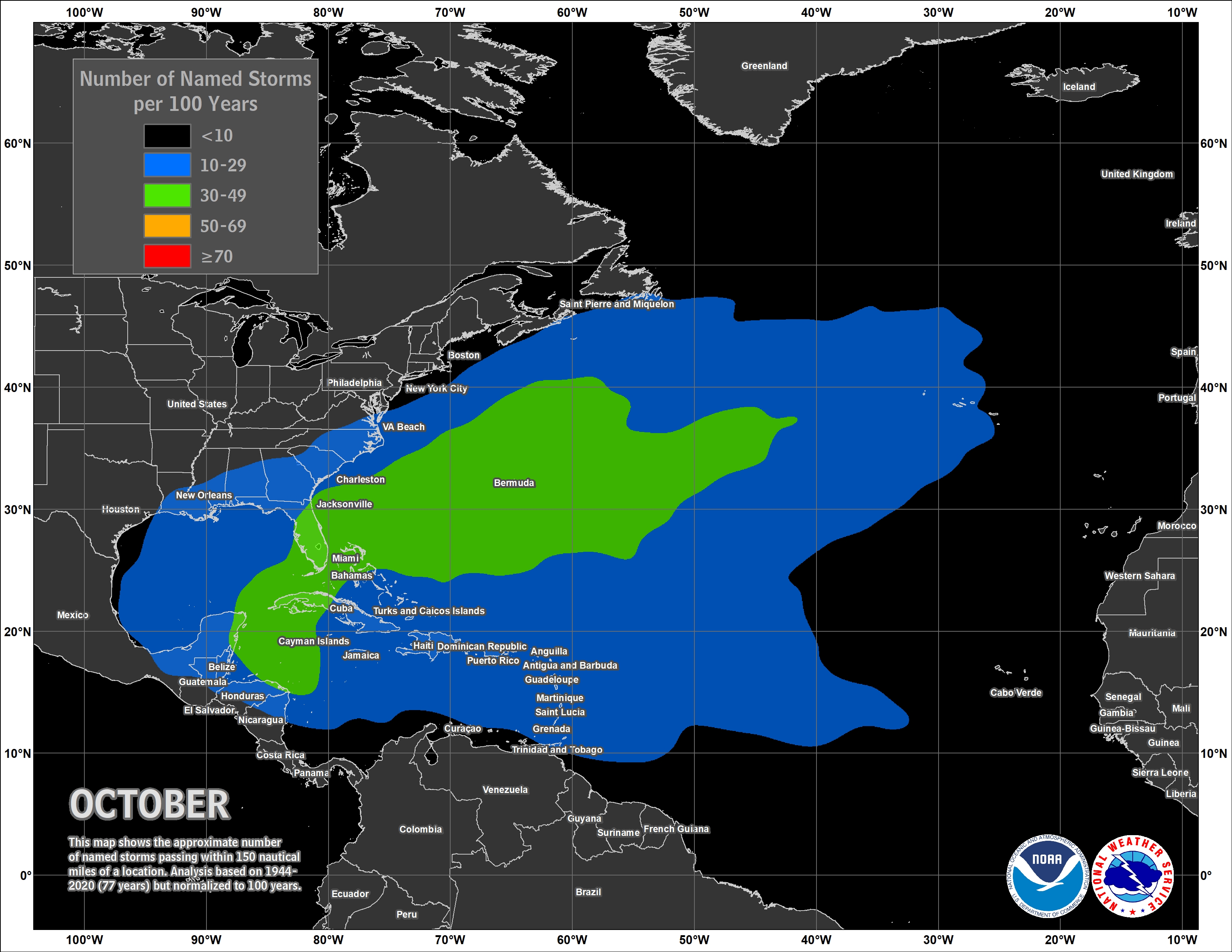 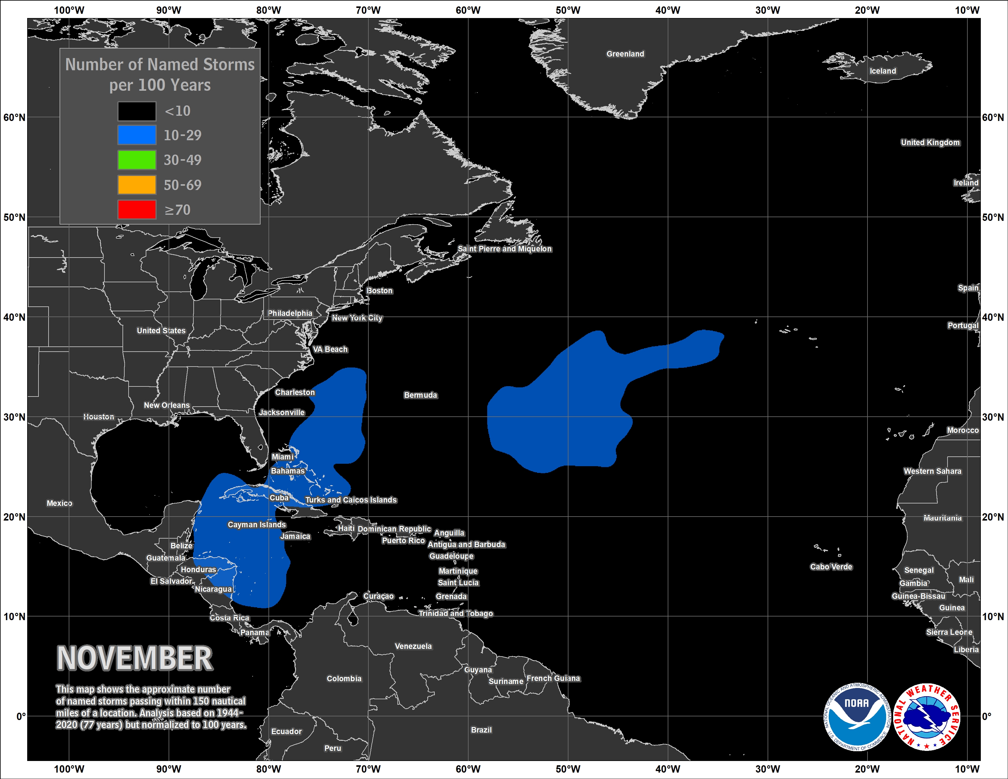 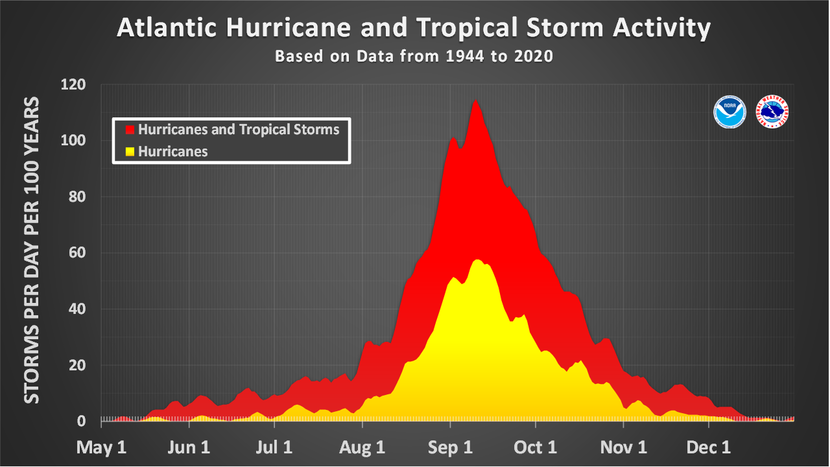 MWP Terms of Service: DISCLAIMER: My website is for general information only and not to be used for any official forecast. Weather is a hobby of mine and having a site for friends and family with as many useful links for hurricane tracking and information has always been my objective. Watch local and National news for your weather making decisions. Not responsible for inaccurate maps or data on this page. PRIVACY POLICY: My website (www.spaghettimodels.com) uses browsing cookies and conducts others means to collect user information in order to display contextual ads.My website (www.spaghettimodels.com) uses browsing cookies and conducts others means to collect user information in order to display contextual ads. - Third party vendors, including Google, use cookies to serve ads based on a user's prior visits to this website or other websites. - Google's use of advertising cookies enables it and its partners to serve ads to you based on your visit to this site and/or other sites on the Internet. - You may opt out of personalized advertising by visiting Ads Settings. You can also opt out by visiting www.aboutads.info. YOUTUBE / API SERVICES: YouTube Terms of Services / Google Privacy Policy By using YouTube users are agreeing to be bound by the YouTube Terms of Service. Mike's Weather Page uses YouTube API Services. User data is not collected, stored, or used by Mike's Weather Page. User data is not processed or shared. Contact for more info. | ||||||||