
Thanks to our 'Title Sponsor'
Sparks Energy

Search for the 'Mikes Weather Page' APP.
APP is .99 a month. You can cancel anytime.
Email to cancel.
Website is always FREE.

If you like Mike's you can donate on
Paypal.
You can also become a Patreon.
Thank you!
CURRENT WEATHER IMAGES/LINKS:
Great Links from
UW-Madison CIMSS


500mb
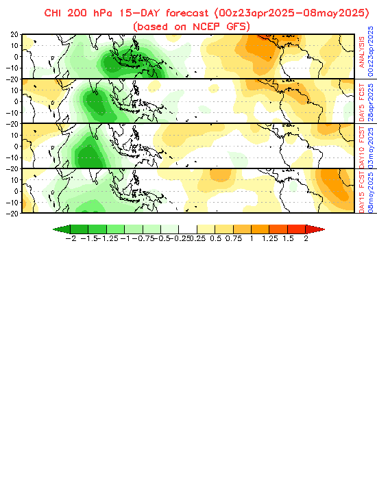
Vorticity / 200mb
Vorticity

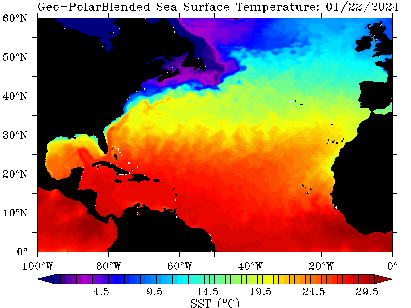
Water Sea Surface Temps:
definition
More Detailed Water Temps
Tropical Cyclone Heat Potential:
definition

Sea Surface Temp Anomaly:
definition


Wind Shear Map:
definition

Winds at Different Layers:
Current Lower Winds
Current Upper Winds
Winds Aloft / Surface Wind
Speeds:

Current Airport Weather (winds/altimeter):

Current Flying Turbulance:

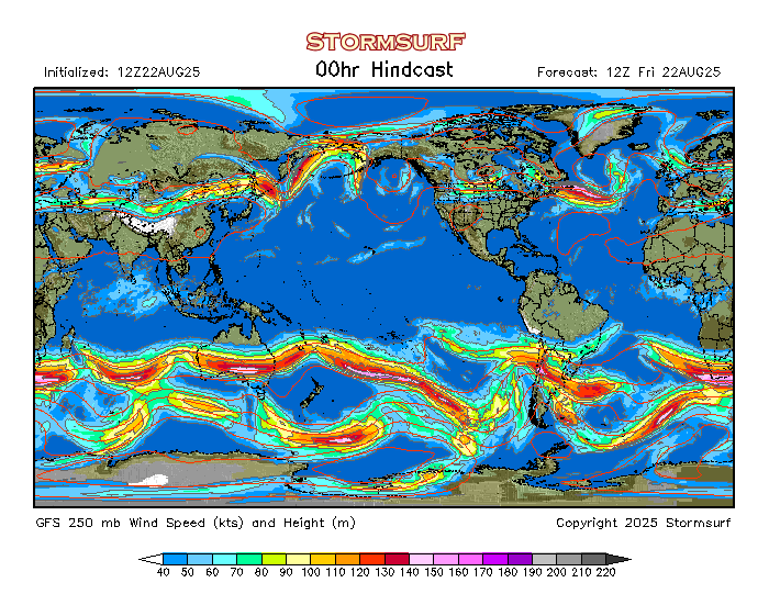
Jet Stream Pattern:
definition
Jet Stream Forecast
/ Jet Stream Page

Global Jet Stream Outlook:
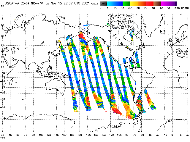
ASCAT/WindSAT Winds
definition
See Current Local Winds / Gusts
Current and Future WindAlert Animations:

Current Winds of the Earth:

Forecast Wind
Conditions
/ See Your WINDS
WINDcast Wind Forecast:

MJO Forecast: definition
(green is active)
North Atlantic
Water Vapor Loop:
definition

Great Water Vapor of Gulf/Atlantic
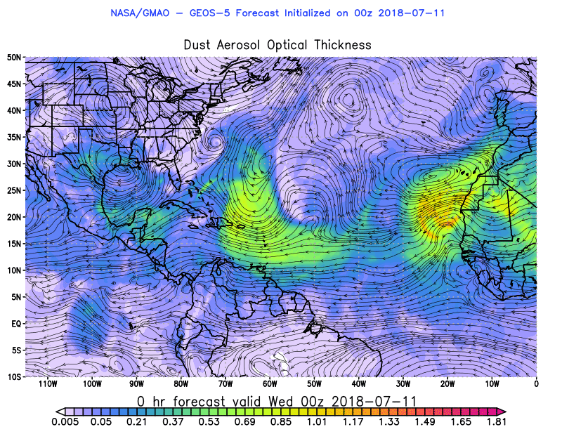
Saharan Air Layer:
definition

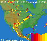
Current Lightning Strikes:
River Forecasts & Observations:

Buoy Data:
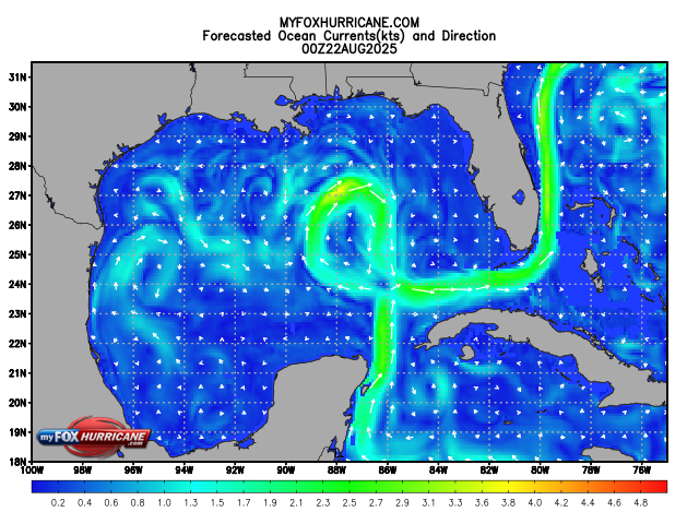
Oceant Currents
/ National
Buoy Center

Storm Surge
Map
/ Storm
Surge Map
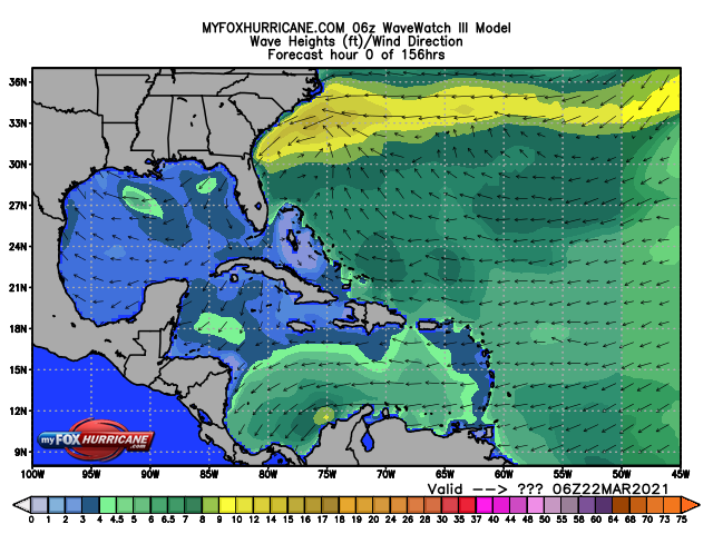
Wave Heights:
Ocean Currents:
Live Marine Traffic Map
/ Wave
Watch Model
Wave Heights:

Wave Height Maps
/ Animated Wave Models
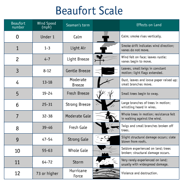
Beaufort Wind
Scale:
definition

NOAA Marine Forecasts by Regions:
U.S.
Coastal Tide Charts

Saffir-Simpson Hurricane Scale:
definition


LIVE Earthquake Page:

Your Bad Hair Day Forecast:


Mikes Backyard Weather - Oldsmar, FL:

E-Mail Mike
 |
|

